Athabasca Glacier
Posted by Stella on Tuesday Jun 21, 2011June 17, my family went to see the Athabasca Glacier. When we first got there, I saw a mini lake. I don’t think it had a name but it was still pretty. [Editor’s note: These were the headwaters of the Sunwapta River, bound for the arctic ocean.] Then, beyond the lake was a huge chunk of ice. I don’t mean huge like the size of my head, I mean huge like 20 football fields. Maybe even 30. Yeah, probably 30. So anyway, Dad said it was a glacier. Athabasca Glacier.
We took a short hike up a hill so we could get closer to it. Ellie, Greta, and I ran ahead, and Ana hung back with the parents. We beat them by about five minutes, and it seemed like forever, but finally they came. We walked a little farther, out to where the rope was. The rope was there to stop people from walking out onto the glacier. There were signs all over telling the stories of deaths or terrible injuries from falling in crevases or the ice breaking and people falling into the freezing cold water. But don’t worry, we didn’t go anywhere near the ice or the river flowing underneath it. We were on land that was about 20 to 50 feet from any ice. We were safe, and we had a nice time.
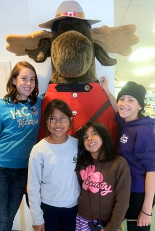
So when we got back down the hill, we raced back to the RV. I was the first one to touch it. When we were all loaded up, we parked across the road in an RV slot in the parking lot for the Icefields Visitor Center and hopped out. We all walked up the stairs to the building. It looked huge, but when we stepped inside, it seemed tiny. I don’t know why.
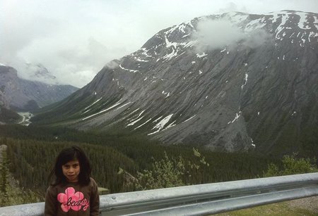
Right now, Dad is reminding me what we learned in there. Dad says that a glacier is an ice river, and the Athabasca glacier is about 4 miles long. He says the glacier moves down the mountain a few inches per day. So, in the picture below, the glacier on the left is 4 miles long and moving slowly down the mountain. The steep parts are like an ice waterfall, and they are called icefalls. In the visitor center, there was this big 3D map that Dad told us to look at. He said that on the top of all the mountains was a huge bowl-like valley. That valley was filled with ice and snow. It is called the Columbia Icefield. It is so big that it covers all the mountains around it and drops a dozen glaciers down from it. Athabasca Glacier is one of them. So do you remember how big I said the glacier was? 30 football fields? Well, the Columbia Icefield is about 125 square miles. So that would be about 60,000 football fields! I told you it was huge!
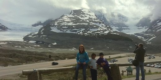
Athabasca glacier flows down from Columbia Icefield in the left valley, Dome glacier flows down the right. Snowdome is up on top, in between them. The icefield extends back on the other side of the mountains.
So Dad says that there’s something called the Continental Tri-vide, or apex, or something like that. I think it sounds better than the triple continental divide, don’t you? Well, on the Continental Tri-vide, if a raindrop or snowflake falls on it, it can go to either the Pacific, Atlantic, or Arctic Ocean. There’s a place on the Columbia Icefield called the Snowdome. The top of the Snowdome is where the apex of North America is located.
We had a fun time at the visitor center and to make it better, as we were leaving, we each got a Canada National Parks passport, and a butterscotch-flavored candy cane.
