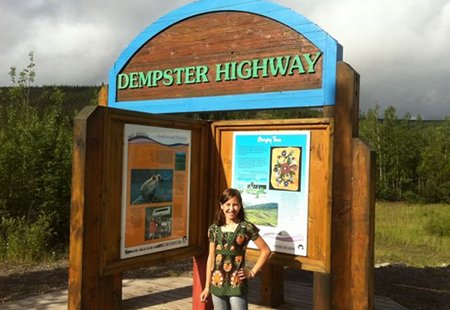
The Dempster Highway
Posted by Van on Friday Jul 1, 2011 Under TravelsJune 28 started with a long, overnight thunderstorm. We awoke to rain, clouds, and mud. Our plan for the day had been to leave Dawson City and make our way across the “Top of the World” Highway to Alaska, which we had heard was incredible, offering mountaintop views out over the tundra and mountains to the north, the river valleys to the south. But, it would be a crime to drive such a beautiful highway in the clouds. So, Plan B. Plan B was to work a full day and depart the next, which had a nice, sunny forecast. But lightning during the night had knocked out the cell phone tower. Apparently there is only one phone tower in the Klondike, and it provides all phone and internet services for a huge region. We were told that it could be a week before service was restored, and the nearest town with internet and phone would likely be Whitehorse, six hours south. Hmm, Plan C was beginning to look like a day of card games and mud castles.
But then Jean came running from the crowded campground office and urged me to come talk to a guy about the Dempster Highway. The Dempster runs north from Dawson, up through a large territorial park, across the arctic circle into the Northwest Territories, and ends in a river delta near the Arctic Ocean. It is a long, long packed-dirt road, and we had ruled it out early on for traveling with the RV. Anyway, this guy had just made the trip up and back, and we talked about the road conditions and the scenery along the lower stretch of the road, about what a big family with a big RV and a crappy Plan C might be able to do in a day-trip up the Dempster.
So we unloaded all the bicycles to save them the beating they would take on the dirt road. We gassed up the camper and off we headed for the Dempster Highway.
It took several hours to make it up into Tombstone Territorial Park, and the scenery was fantastic, even in the clouds and rain. The road went up a glacial mountain valley, alongside streams and wetlands. A low pine forest covered the valley floor, much like we had seen all throughout the Dawson area. Then we crossed the (Pacific/Arctic) continental divide and entered the sub-arctic tundra. The trees disappeared and the ground was covered with chest-high bushes and shrubs. Everything was green (except for the very-blue snow here and there), and everything was much more alive than I would have guessed for the frozen north.
The seemingly bare mountains were amazing. And there were critters, many critters. But I will leave that story for Luciana.
Leave a Reply
You must be logged in to post a comment.
